When I was searching for information on Hajj, I came across many books and online articles. Most of the books published are mostly limited to legalities of actions and take much of the material from older books with limited insight to what we experience on ground. Same is the case with most of the online articles, where people share their experience or Hajj diaries. My intention is to write a complete story of Hajj with latest information and tips/tricks that can help people to avoid hustle and make up their minds for what is going to happen on their journey.
Basic mina and Arafat activities and issues have been discussed in respective pages (Mina & Arafat). The directions for maps and country-wise distribution is the most searched keyword/part during Hajj. The government Hajis from Pakistan normally get same locations each year in Mina and Arafat.
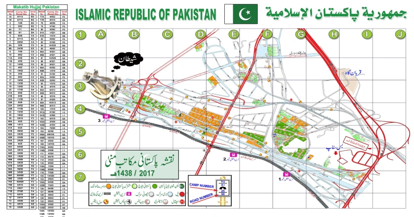
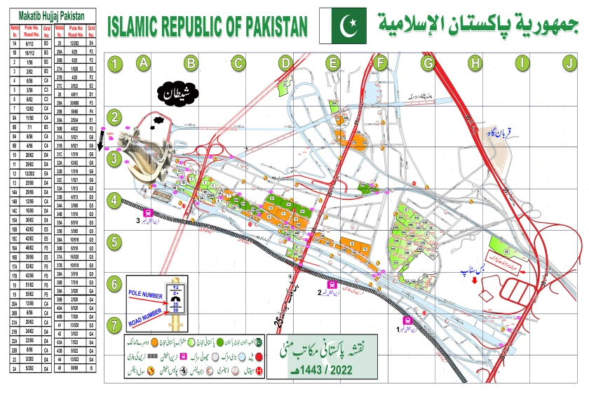
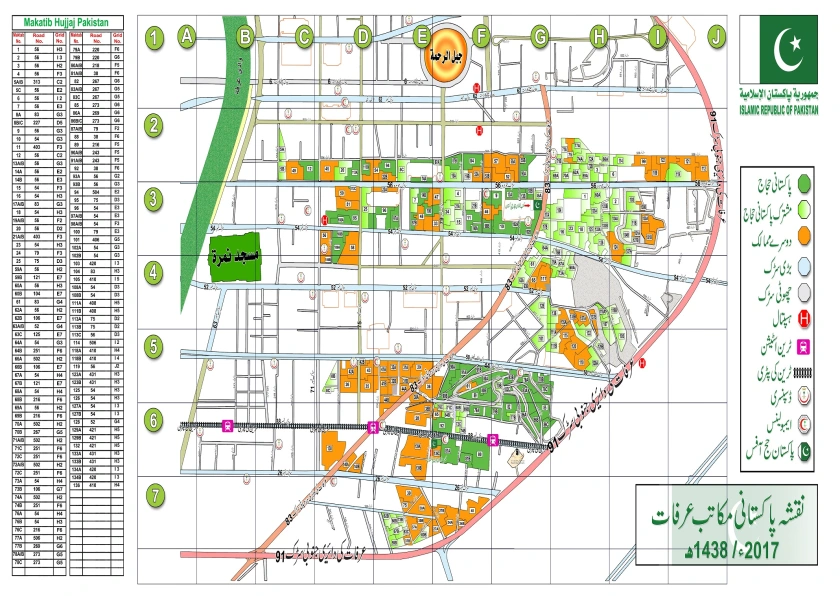
The map for Pakistani camps in Mina for year 2017 is given below. Current maps are available with volunteer/Ministry officials present in Mina in green jackets. The same may be downloaded in good resolution from Official Hajj website here. In this map, green area outlines Pakistan, Orange for other countries. The maps for 2022 for Pakistan are available here.
Mina Camps Maps for Pakistan
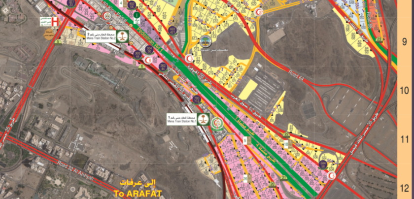
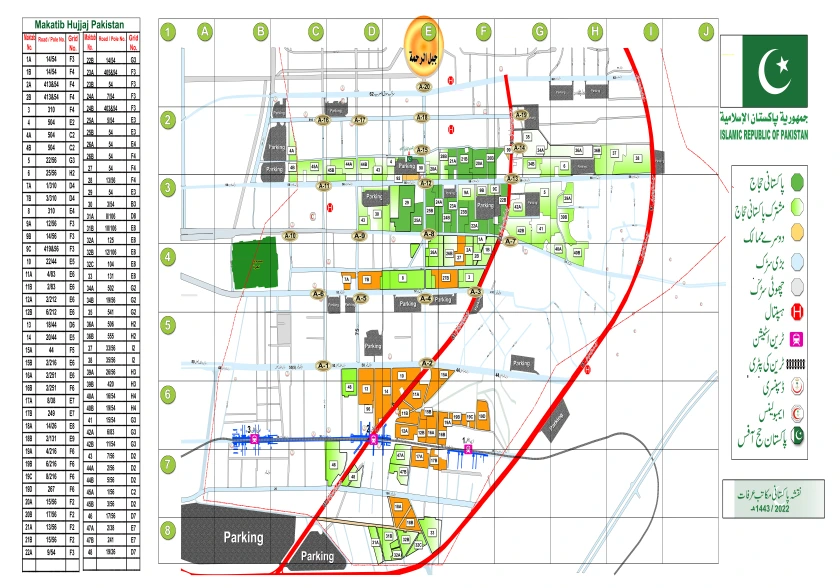
Saudi Ministry of Hajj and Saudi Scouts organization update these maps on Yearly basis. Zoomed in Map for Mina around Mina-1 Station is given below for year 2017.
Map of Mina camps for 2017 (above) and 2022 (below)
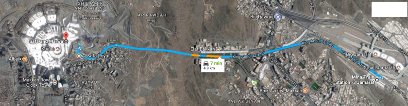
The direction from Mina to Haram is shown in Map below. The main backbone/road for Mina is the King Abdul Aziz road, which passes throughout Mina to Muzdalifah adjacent to the train stations. The same King Abdul Aziz Road leads to Haram from Jamarat point (Mina-3 station). Bin Dawood is visible on right side of the road. The tunnel either leads to Safa point or the Ajyad.
Mina to Haram Road
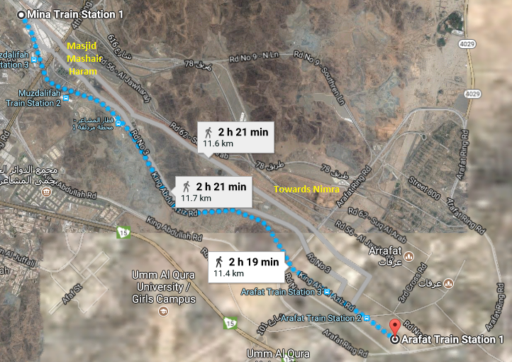
The direction from Mina-1 Station (Which is actually inside Muzdalifah boundary) to Arafat has three routes, including one via King Abdul Aziz Road.
Mina to Arafat Map
The route is about 12Km (almost 3-4 hrs walk), and will lead towards the boundary of Arafat on opposite side of Masjid Nimra, Near Arafat-2 and Arafat-1 Stations, where most of the South Asian/Pakistani Camps are present. Other two roads (Pedestrian Road 2 and 3) highlighted in grey are of similar length but lead towards Masjid Nimra or Arafat-3 Station.
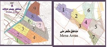
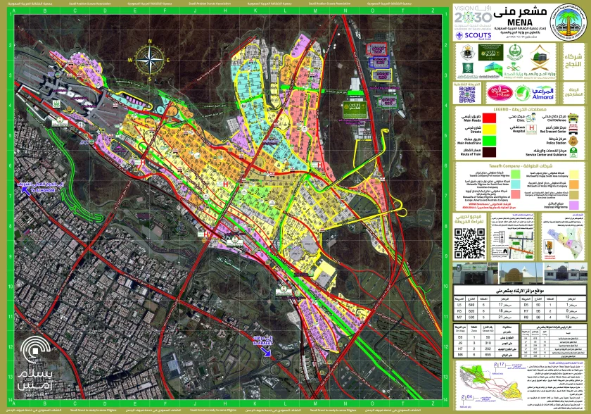
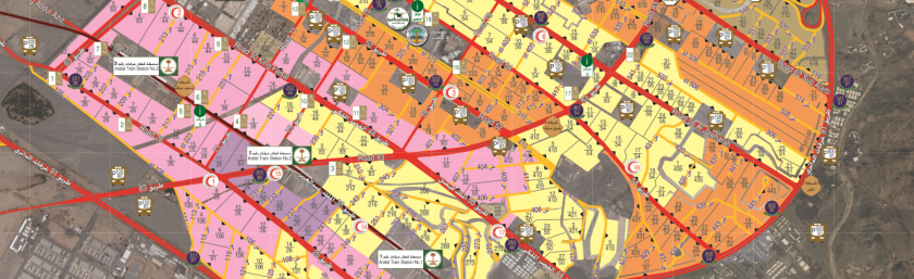
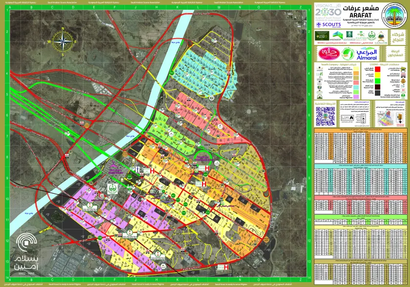
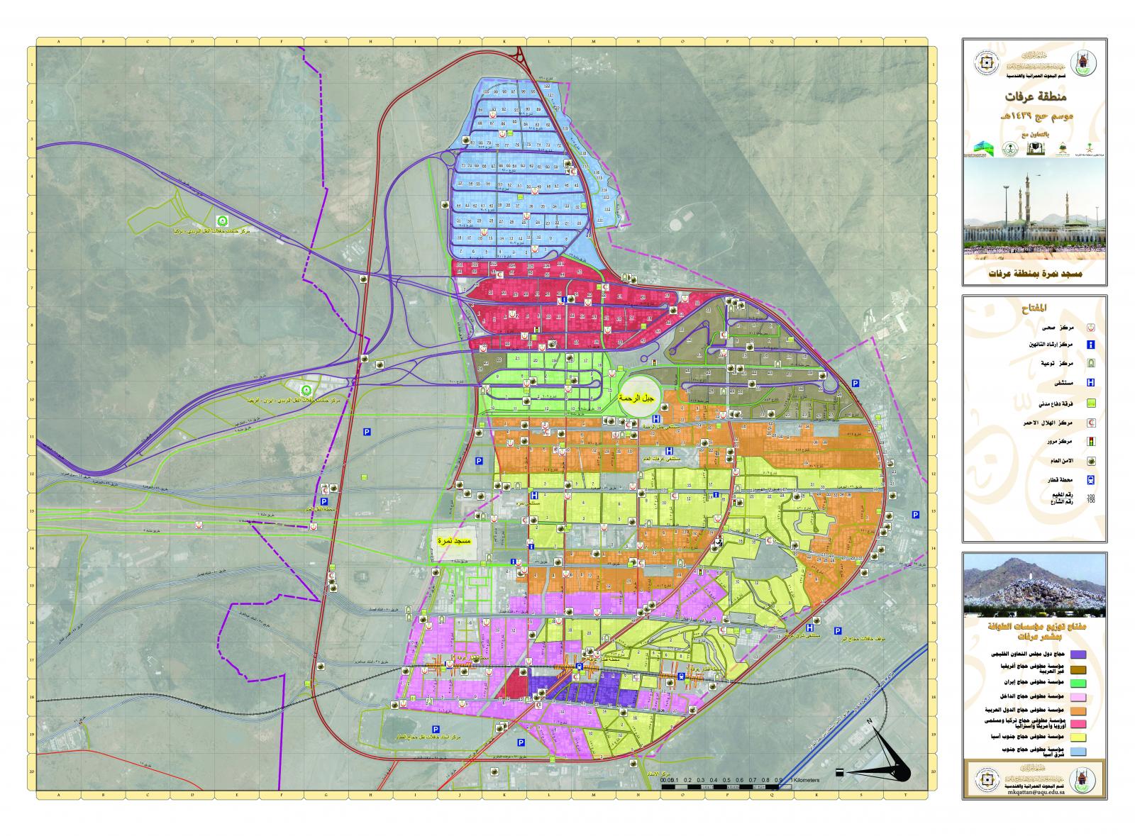
The detailed Mina and Arafat map for 2017 are also available on the Saudi Arabia Scouts website in PDF format. Current maps are updated on this location. The zoomed-in image of that map is given below. It is clear from the PDF below that the YELLOW region is the camps for South Asian countries.
Map of Arafat camps for 2017 & 2022
Hopefully, the location will be updated with respective years’ maps/guidelines in future. The detailed map (PDF) shows the colour codes for countries, the zones/camp no. nomenclature in maps, similar to that given by Haji camp. The details of services including Hospitals, stations and bus stops etc are also given in the maps.
The high resolution maps for Mina and Arafat may be received via contact section on email. OR Downloaded from following links.
